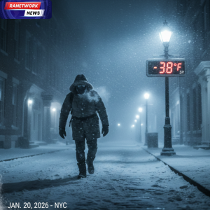
The Situation A “disruptive and dangerous” Arctic air mass has officially arrived, pushing temperatures to subzero levels across the Eastern United States. National Weather Service (NWS) offices from the Midwest to New England have issued Wind Chill Warnings, affecting over 100 million people.
Key Weather Impacts
-
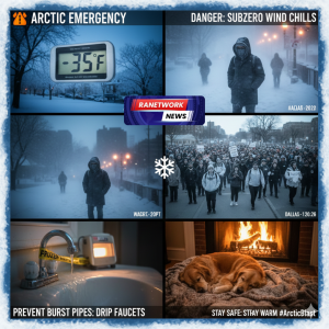
Life-Threatening Cold: Wind chills are expected to reach “dangerously low” levels. In northern states, values could plummet to -40°F, while even the Mid-Atlantic will see “real-feel” numbers well below zero.
-
Flash Freezes: Any standing water from previous precipitation will freeze instantly, making roads and sidewalks treacherous.
-
Infrastructure Strain: Energy providers are bracing for record-breaking heating demand. Residents are urged to conserve energy where possible to prevent rolling brownouts.
Safety Recommendations Authorities are emphasizing that this is not a standard winter cold snap.
-
Frostbite Risk: At -20°F wind chill, frostbite can occur on exposed skin in 10-30 minutes.
-
Pet Safety: If it is too cold for you, it is too cold for your pets. Bring them indoors.
-
Home Care: Ensure your heating system is functioning and keep a slow drip in your faucets to avoid the high cost of burst pipes.
Forecast Outlook The core of the Arctic air is expected to settle over the East for the next 48 to 72 hours. While a slight “warm-up” is predicted by early next week, the immediate threat remains extreme.
Stay tuned for live updates as the temperature continues to drop.